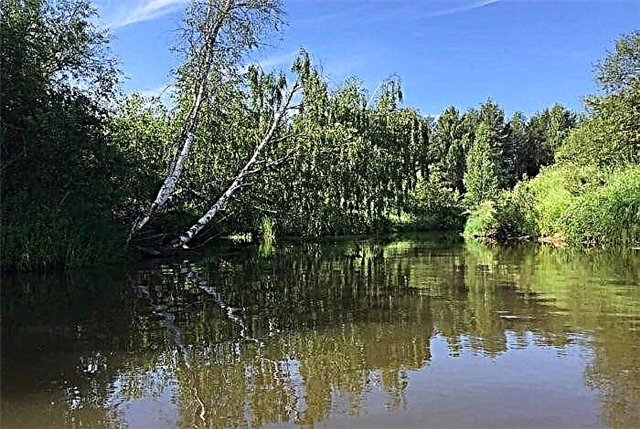
The Ivanovo region is called the edge of the rivers. More than 50 rivers are more than 50 km long, and about 1500 rivers in the region are less than 10 km long. The rivers of the Ivanovo region belong to the basin of the Caspian Sea. Mostly these are flat rivers with a calm flow and a minimal slope. The main rivers of the region are the Klyazma and Volga, which also flow in other regions.
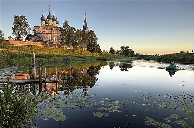
The rivers of the region are called by hydrologists one of the cleanest in the country. This is also noted by amateur fishermen, because fishing even in a small river can bring a good catch. The cleanest is the water in the Teza River. Rafting and hiking trails for tourists are laid along many rivers. They combine rest among the picturesque nature, visiting the monuments of history and archeology, visiting villages with old churches.
The longest rivers of the Ivanovo region
List of the largest rivers flowing through the region.
Volga
The Volga carries its waters through the territories of 4 republics and 11 regions in the European part of Russia. Popular tourist routes run along the famous river. The oldest city in the Ivanovo region, Yuryevets, is located on its banks. Among the forests of the right bank of the Volga is the resort town of Ples, where great and famous artists - Levitan, Savrasov and Repin - came to create.
The length of the river is 3530 km, in the Ivanovo region - 173 km.

Klyazma
The banks of the river are rich not only in nature, but also in cultural and historical values. These places are great for sightseeing excursions. Rafting is more interesting in the lower part of the river, moreover, the water is much cleaner here than in the upper reaches. Hiking with tents is popular on the banks of the Klyazma. It flows through several regions - Ivanovo, Moscow, Vladimir and Nizhny Novgorod.
The total length of the river is 686 km.

Nerl
The upper reaches of the river pass among high hills, the banks of the river are covered with dense coniferous and mixed forests. Further downstream, forests give way to meadows. The Nerl is not a navigable river, but the rafting is interesting along its entire length. Forest landscapes and cozy small villages with ancient churches will not leave anyone indifferent. It flows through the Yaroslavl, Ivanovo and Vladimir regions.
The length of the river is 284 km, in the Ivanovo region - 125 km.

Luh
Interesting rafting routes pass along the river. They are varied and are suitable both as a weekend walk and as a serious multi-day hike. The calm river routes are suitable even for beginners. There are no obstacles in the river, and the banks are convenient for parking. There are areas covered with white soft sand. Luh flows through the Ivanovo and Vladimir regions, as well as along the border with the Nizhny Novgorod region.
The length of the river is 240 km, in the Ivanovo region - 220 km.

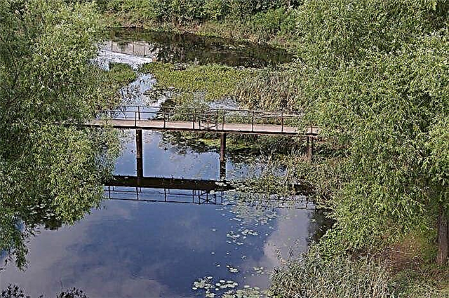
Teza
The source of the river is in the Kozlovsky swamps. Part of the winding river bed flows through picturesque meadows. Below the city of Shuya, the river banks become open, overgrown with willows. Five dams with sluices have been built in these places. The Zmeevsky burial ground contains the burials of the Fatyanovo archaeological culture. The river is interesting for water and hikers. Several rafting routes have been laid along it.
The length of the river is 192 km.

Take away
It is one of the tributaries of the Klyazma. The source comes from the Andreevsky bogs in the north of the region. The banks of the river are mostly covered with forest. A little higher than Ivanovo, the river fills the Uvod reservoir with water. It is necessary for urban water supply. Part of the water in the reservoir comes from the Volga-Uvod hydrotechnical canal. Lead flows through the Ivanovo and Vladimir regions.
The total length of the river is 185 km.

Recommended: 45 main sights of Ivanovo.
Measure
The protected shores of Mera with natural nature are interesting for travelers. The clear waters of the river flow along a sandy channel among coniferous forests. The ichthyofauna of the river is diverse - it is home to asp, crucian carp, bream, perch, roach. Mera flows into the Volga near the cities of Zavolzhsk and Kineshma. There are many ancient temples, museums, and architectural monuments in them. It flows through the territories of the Kostroma and Ivanovo regions.
The total length of the river is 152 km.

Nemda
In the Mari language, the name of the river means "bird cherry river". Nemda is actively used by tourists and travelers for rafting and fishing. Scenic forest areas alternate with no less beautiful meadow areas. The nature of the river will not leave anyone indifferent. Recreation centers have been built on the banks of the Nemda; you can also rent a house in the village. It flows through the territories of the Kostroma and Ivanovo regions.
The total length of the river is 146 km.
Solonitsa
The source is located in the Piscovye bogs of the region. The name of the river comes from the properties of the water in it - there are several mineral salt springs in the Solonitsa valley. Useful properties of water are used in sanatoriums and recreation centers built on the banks of the river. Solonica is inhabited - bleak, ide, perch, bream, crucian carp are found in it. In addition to the Kostroma region, it also flows in the Ivanovo and Yaroslavl regions.
The total length of the river is 138 km.

Mesa
It flows through the Ivanovo and Kostroma regions. At the same time, only the source of the river and an insignificant part of the upper course are located in the Ivanovo region. The width of the Mesa in the region does not exceed 10 meters. There are many rifts, rubble and shallows. The bottom of the river is sandy or silty-peaty. The banks are overgrown with forest. The river is suitable for rafting, the nature on the banks looks especially beautiful in spring, when the bird cherry blossoms.
The total length of the river is 125 km.

Saggy
The source takes in the swampy area of the Ivanovo region. The estuary is located in the Yaroslavl region near the village of Strokovo. Part of the river flows along the border of the two regions. Remains of ancient settlements and abandoned mills are located on the banks of the river. The Lakhosti channel is not wide, the current is calm. There are many great fishing spots. Otters and beavers live on the shores. In the lower reaches of the river, a nature reserve has been established.
The total length of the river is 91 km.

Ukhtokhma
The source of Ukhtokhma is in swamps. It flows into the Uvod river. The river in its middle reaches is popular with vacationers. The waters of the river are cleaner here than in the lower reaches, and the nature amazes with its beauty. A dam was built on the river near the city of Komsomolsk, which forms a large reservoir. The river bed is slightly tortuous, the current is calm. The maximum depth of Ukhtokhma does not exceed 3 meters, the width is 30 meters. The banks are covered with forests.
The length of the river is 89 km.

Poksha
Known as a clean river, its waters are clear. One of its tributaries is the rapid Sendega River 28 km long. After merging with it, the depth of Poksha reaches 4 meters. The river is not navigable, but kayaking is possible. Poksha is inhabited by pike, bleak, ruff, roach, ide, chub. It flows through the Ivanovo and Kostroma regions. It flows into the Gorky reservoir of the Volga.
The total length of the river is 89 km.

Vyazma
The source is located near the village of Nikolskoye in the Shinilovo swamp. It flows into Uvod. It flows among partially swampy forests. In summer, the river bed is overgrown with algae. The flow of Vyazma is slow. The width of the river ranges from 5 meters to 15 meters in different sections. Vyazma has several large tributaries. The river is home to many species of fish. The most common are bleak, roach, crucian carp, chub, and perch.
The length of the river is 86 km.

Zhelvata
Formed by the confluence of the Elnati and Poronzha rivers. It flows into a large reservoir on the Volga and enters the river basin of the Caspian Sea. The river flow is calm, so it is suitable for rafting. Mostly these are ordinary walking routes, without rapids and rapids. The river is also interesting for fishermen - pike, perch and roach live in it. It flows in the Kostroma region and along the border with the Ivanovo region.
The total length of the river is 77 km.

Ukhtoma (tributary of the Nerl)
The source of the river is in the forests near the border with the Yaroslavl region.The area around the river in the 15th century was called Ukhtomskaya volost, and the princes who owned it had the surname Ukhtomsky and belonged to the Rurik family. The river has several tributaries. The longest of them is the Sukhoda River, 46 km long. The name of the river comes from the Finno-Ugric language from the word "ukht", meaning "union, union".
The length of the river is 71 km.

Irmes
In 2001, an ancient archaeological settlement was discovered on the banks of the river by the staff of the Institute of Archeology of the Russian Academy of Sciences. According to the research of scientists, people lived here in different periods - in the IX-X centuries and in the XII-XIII centuries. The Imres is not a navigable river. There are several small villages and one city on it - Gavrilov Posad. The banks of the river are covered with bushes and willows. It flows through the territories of two regions - Ivanovskaya and Vladimirskaya.
The total length of the river is 70 km.

Scab
It flows out of the swamps between the cities of Rodniki and Vichuga, the first kilometers of the river are more like a large stream. Near the village of Parskoye, the river becomes wider and reaches 20 meters. Closer to the mouth, the width of the river is 30 meters. The banks of the river are covered with forest and alder. A dam was built on the river near the village of Shavrigino, and a dam was formed. The largest tributary of the Parsha is the Shokhonka River, 12 km long.
The length of the river is 65 km.

Luleh
The upper reaches of the river pass among desert swampy banks. Closer to the middle course, the river takes on a picturesque look - a mixed forest appears on the left bank of the river, fields and meadows appear on the right. An interesting tourist route has been laid along the Lyulekh River, passing from the village of Kruttsy to the mouth. Tourists can see the archeological monuments preserved here - ancient Russian settlements and sites of the Neolithic era.
The length of the river is 60 km.

Shacha
It flows through the Kostroma and Ivanovo regions. It is a tributary of the Volga and flows into the Gorky reservoir. It is not navigable in the Ivanovo region, but kayaking is possible. The waters of the river are polluted, local residents blame the enterprises that dump industrial waste into it. There are three cities on the river. The longest tributary of the Shachi is the Osya River, 23 km long.
The total length of the river is 58 km.
Shizhgda
Several centuries ago it was called Shizhekhta. It flows into the Klyazma near the border with the Vladimir region. The source of the river is located near Shorygino station. Shizhgda flows in reserved, uncrowded places. Perhaps because of this, a large number of fish live in it. Beavers, moose and wild boars live in forests and wetlands around the river. There are old abandoned villages.
The length of the river is 57 km.
Dobritsa
Tributary of the Lukh River. The source of the river is located near the village of Alyushkino. The banks of the river are densely populated, but settlements are represented mainly by villages and small villages. The largest village is Annunciation with a population of just over 200 people. Here you can see the church built at the beginning of the 19th century. Dobritsa has several tributaries - small rivers and streams no more than 20 km long.
The length of the river is 57 km.

Nodoga
Also known as Nodozhka. It carries water through two regions - Kostroma and Ivanovskaya, partly passing along the border between them. It is a tributary of Zhelvaty. Nodoga flows among the forests, the banks of the river are not inhabited. But fishermen come to her - bleak, pike, roach, bream live in Nodoga. The river is also used for rafting. Tourists rarely come here, but it helps to preserve the pristine beauty of nature.
The length of the river is 56 km.

Yolnat
It flows into the bay of the Gorky Reservoir near the village of Mikhailovo. The source takes in swampy forests, on the site of a glacial lake. The upper course runs along flat terrain, here Yolnat looks more like a calm small stream. For several kilometers it flows among small hills, here the flow of the river becomes faster. At the mouth, the river becomes flat again.
The length of the river is 54 km.

Landeh
Formed by the confluence of the rivers Kokhtovets and Popikha. It flows into the Lukh River, the mouth is located in a swampy area. Peat mining is underway near the village of Mugreevsky in the lower reaches of the river. Rafting can be organized along the river, most often these are routes of one day. Local fishermen talk about a good catch of pike. But there are also crucians, perches, rudd. There are several villages on the river - Upper and Lower Landekh, Starilovo.
The length of the river is 53 km.

Molokhta
The river takes its source in the swamps near the village of Ozerny. Peat extraction sites are located there. There is a network of canals around the regulated river bed. In the upper reaches of the Molokhta, the Volga-Uvod canal crosses. Here the river forms several lakes. One of them is Vysokovskoye, with an area of 36 hectares. In the lower and middle reaches on the banks of the river there are many villages. Molokhta flows into the Teza River near the village of Vvedenie.
The length of the river is 49 km.

Suhoda
Tributary of the Ukhtoma River. A shallow river that is not navigable. There are several small settlements along the river - Eremeevo, Bolgachinovo, Kovarchino. Earlier in Sukhod there were a large number of different types of fish - crucian carp, burbot, pike. But lately the waters of the river have become dirtier and there are fewer fish. The tributaries of the Sukhody are Shora, Bogdanovka, Pelzhanka, Nichenka. Their length is no more than 20 km.
The length of the river is 46 km.

Sunzha
The river originates near the village of Bolshoye Gaidarovo and flows into the Gorky reservoir of the Volga. From the beginning of May to the end of autumn, bleak and roach are well caught in Sunzha. In October - perch, in winter - roach, silver bream, borer. The river has several tributaries up to 20 km long. There are settlements on the banks of the river - Kamenka and Novopiskovo. A birch grove, planted at the beginning of the 20th century, has survived in Kamenka.
The length of the river is 45 km.

Kistega
It flows in the Zavolzhsky district of the region. The source is located at the Osinovka tract, and flows into the Volga near the village of Khmelevo. Several decades ago, Kistega was navigable - not only boats passed through it, but also barges and floating cranes. From ancient times, the remains of water mills and temporary housing for seasonal workers on rafting have been preserved. The ichthyofauna of the river is made up of roach, pike perch, bream, and perch.
The length of the river is 41 km.

Saneba
It flows through three districts of the Ivanovo region. It flows into the Ukhtokhma River. Saneba is a shallow river with a rapid flow. The winding riverbed runs through the forest. Mainly alder, pine, aspen grow in it. The water in Saneb is clean and cold. In many areas, the river has a great depth even at the very shore, during floods it often overflows. Saneba is used for boating.
The length of the river is 36 km.