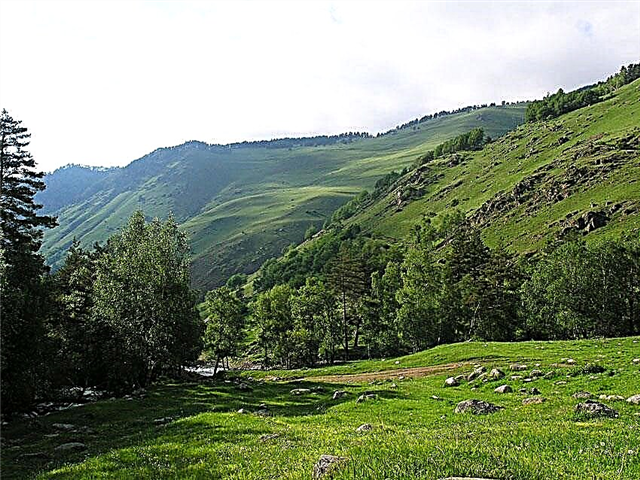
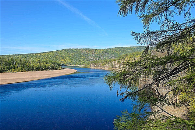
More than half of the territory of the Amur Region is mountainous. Therefore, many rivers in the region have similar characteristics - their source is located in the spurs of mountain ranges, the current in the upper reaches is rapid and passes through narrow valleys, often with steep and high banks. The middle and lower reaches of the rivers pass either along the Amur-Zeya plateau, or along the Zeya-Bureya plain. In these areas, the rivers are of a typical flat character.
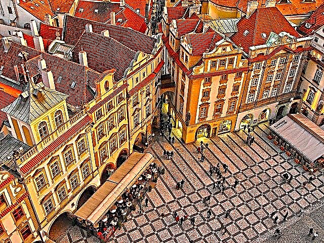
Rivers in the Amur Region flow through picturesque places with wild nature and are often difficult to access. More attractive for tourism are the large rivers - Zeya, Amur, Selemdzha and Bureya. Tourist water routes are laid along them. Historical and archaeological monuments are located on the banks of the rivers; some of the rivers flow through the territory of state reserves.
The longest rivers in the Amur region
List of the largest rivers flowing through the region.
Amur
One of the ten largest rivers in terms of water basin area. The river is navigable and walks along it are very popular with tourists. There are many archaeological and natural attractions on the banks of the rivers. It flows in the Khabarovsk and Trans-Baikal Territories, the Jewish Autonomous and Amur Regions, as well as through Mongolia and the Heilongjiang Province in the PRC.
The length of the river is 2824 km, in the Amur Region - 1246 km.

Olekma
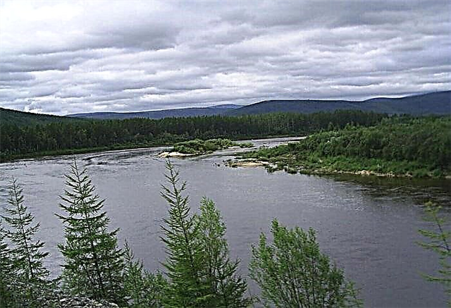
Northern river with cold water, at the mouth of which there are thermal springs. It flows through seven mountain ranges and several nature reserves, the shores have constantly changing landscapes. Traveling around Olekma will be extremely exciting, tourists often travel on it both by boats and kayaks. It flows through the Amur Region, Yakutia and the Trans-Baikal Territory.
The length of the river is 1436 km, in the Amur Region - 246 km.

Zeya
A tributary of the Amur, while in some places the depth and width of the river exceed the Amur. Zeya is navigable for 650 km. Barriers to movement on the river are shallow rifts. The river in its upper reaches has a mountainous character, since its source is located on the Stanovoy ridge. Dwellings of ancient people and archeological monuments were found on the banks of the river. The river is used for water supply and timber rafting.
The length of the river is 1242 km.

Selemdja
It flows through the taiga, deciduous and coniferous forests. Deposits of coal, copper and gold were discovered on the banks of the river. Also on the banks are the remains of the Selemdzhin culture, which existed about 10-25 thousand years ago. The source of Selemdzhi is located in the spurs of mountain ranges at an altitude of 1525 meters. Near the working village of Fevralsk Selemdzhu is crossed by the Baikal-Amur Mainline.
The length of the river is 647 km.

Bureya
The river is most popular for rafting in the upper reaches; this section passes through the mountainous area and has a turbulent current. The hydroelectric power stations erected at Bureya create the Bureya cascade. On the banks of the river there are ancient sites of people of the Gromatukha culture. There are more than 1,500 lakes of various sizes in the river basin. Bureya carries its waters through the Amur Region and the Khabarovsk Territory.
The length of the river is 623 km, in the Amur Region - 250 km.

Nyukzha
It begins on the mountain range of the same name. In the upper reaches, the river valley is narrow. Its bed is divided into sleeves. The river flow is rapids. Lovers of rafting and water travel, as well as fishermen, often come to the river. It is inhabited by minnow, char, pike, taimen. At the confluence with the Onen River, drawings from the Iron Age were discovered. It carries its waters through the Amur Region and the Trans-Baikal Territory.
The length of the river is 583 km., In the Amur region - 460 km.
Giluy
Zeya tributary. The source is located on the slopes of the Stanovoy Range. For the most part, the river flows in a canyon-like gorge and among the wilderness of the larch taiga. There are many rapids and rapids in the upper and middle reaches of the Gilyui River. The river bed is meandering, it has steep and steep banks. Gold nuggets weighing up to 10 kg were found in the gold mines on the banks. Gilyuy is popular among rafting enthusiasts and fishermen.
The length of the river is 545 km.

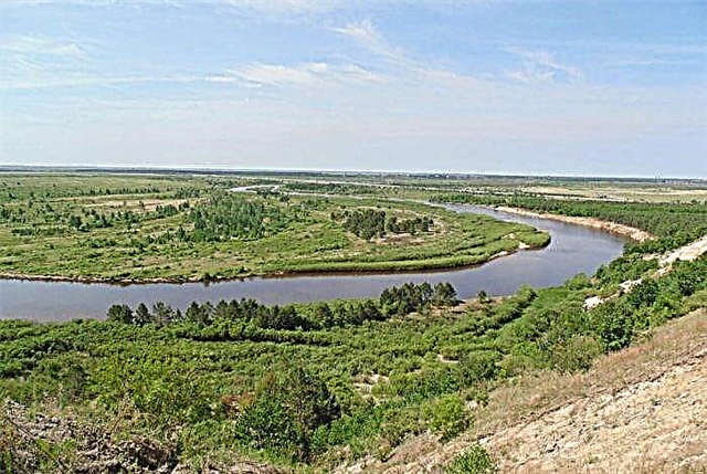
Tom
The river has a mountainous character in the upper reaches. The source of Tom is located on the Turan mountain range. In the middle reaches, the river acquires a flat character, as it goes to the Zeisko-Bureinskaya plain. In this area, it has a branched channel, a slow current, the shores are predominantly sandy and easily eroded. The river is floatable. The city of Belogorsk, founded in 1860, is located on the river.
The length of the river is 433 km.
May
May is formed by the confluence of the Ayumkan and Kun-Manye rivers on a mountain range at an altitude of 1100 meters. This wide river, flowing in the taiga, has a fast flow and a winding bed. There are no settlements in the river valley, and it is little studied. Despite the inaccessibility, its picturesque shores attract fans of rafting and fishing. It flows through the Khabarovsk Territory and the Amur Region.
The total length of the river is 363 km.

Niemann
The beginning of the river is located on the Aesop mountain range with a height of 1902 meters. It is composed of granite and volcanic rocks. In its upper reaches, there are artels for gold mining. In the only settlement on Niman, the village of Sofiysk, geological expeditions are working. It flows through the Khabarovsk Territory and the Amur Region, the border between them runs along the middle course of the river.
The total length of the river is 353 km.

Argi
Previously, it was a tributary of the Zeya River. After the construction of the Zeya hydroelectric power station, it flows into the Zeya reservoir. The source of the river is on the slope of the Jkgdyr mountain range. The valley of the river is uninhabited; only three small settlements are founded on its banks - Verkhnezeysk, Gorny and Bomnak. The nature of the river is suitable for light rafting, because most of the route it flows along the Upper Zeya plain.
The length of the river is 350 km.

Dep
The beginning of the river is Lake Ogoron, and for the first few kilometers it has a mountainous character. Below, the river flows in a flat lowland and has a calm flow. The banks in these places are partially swampy. For 60 km, the Dep flows through the territory of the Verkhne-Depsky reserve. This site is notable for its special natural and economic value; rare species of animals live here.
The length of the river is 348 km.

Ulm
The river takes its source on the ridge of the Turan mountains. The lower and middle course of the river passes through the Ulminsky reserve. The nature on the banks of the river is incredibly picturesque. A large recreation center has been built for those wishing to relax among the pristine nature. Fishermen, sportsmen, children and adults come to it. At the request of vacationers, the staff of the base organizes hiking and water trips, active outdoor activities.
The length of the river is 346 km.

Bryanta
It flows into the Zeya reservoir. There are no settlements on the river. The nearest village, Dipkun, is located 30 km from the river. The banks of Bryanta are covered with an impenetrable dense taiga forest. Most of the river is fed by rain, in summer there are often large rain floods. The rivers Utugay and Unakha are tributaries of the Bryanta, almost 300 km long. Whitefish, taimen, grayling, pike and catfish live in large numbers in the river.
The length of the river is 317 km.

Nora
It is a tributary of the Selemdzha River. The source of the Nora is located on the Jagda ridge. The nearest settlement to the river is the village of Norsk, located 6 km from its mouth. The river valley is very swampy, there are many oxbow lakes in its basin. The river is suitable for rafting, but not very popular due to its distance from civilization and swampy shores. The Burrow is inhabited by grayling, pike, ide, taimen, lenok, and silver carp.
The length of the river is 305 km.

Urcan (lower tributary of the Zeya)
A flat river that flows along the Amur-Zeya plateau. The swampy floodplain of the river is occupied by oxbow lakes. Lenok, taimen, carp, silver carp and other fish species live in Urkana. In the upper reaches, the river banks are covered with a taiga forest, where wild animals live - bears, tigers, fur-bearing animal species. In the lower reaches there are meadows.They look especially beautiful during the flowering of peonies and lilies.
The length of the river is 304 km.

Unakha
The river has a winding bed. There is a gold deposit with an area of over 80 km² in the Unakhi Valley. Since 1910, a meteorological station has been located in the middle reaches of the river, which in 1943 became a hydrological station. The Ilikan and Unakhakan rivers are large tributaries of the Unakha. The source of the river is located on the slopes of the Stanovoy ridge, and Unakha flows into the Zeya reservoir, although it is officially a tributary of the Bryanta.
The length of the river is 287 km.

Oldoy
The source of the river is on the Chernyshev ridge in the mountains. In the upper reaches, the river valley is narrow, the banks are steep. After crossing with the Trans-Baikal Railway, the river valley expands, and many lakes appear in the river basin. At the same time, the slopes of the river valley remain steep. The name of the river Oldoy, translated from the Evenk language, sounds like "fish river". Its ichthyofauna consists of lenok, trout, taimen, and grayling.
The length of the river is 287 km.

Utugay
The meandering river bed is crossed by the Far Eastern railway. The upper reaches of the river are located on mountain ranges and in this section it has a rapid current and a narrow valley. The river bed is rapids with a large number of rifts, the bottom is pebble and boulder. Catfish, taimen, grayling, whitefish, pike live in Utugai. But fishermen rarely come to the river, because there are no settlements on it and the river is difficult to access.
The length of the river is 285 km.

Tygda
It is a tributary of the Zeya River. The source of the river is located on the Amur-Zeya plain. The river bed is meandering, its flow is slow. The Tygda Valley is located in a wetland area. The lower course passes through the Ust-Tygdinsky reserve. The waters of the river are inhabited by fish typical for this territory - pike, grayling, taimen. In the Evenk language, the name of the river means "bad weather" or "continuous rain".
The length of the river is 264 km.

Curled
The source of the river is located in the forests of the Zeya-Bureinskaya plain. The valley of the Zavitaya river is wide, its current is slow. The upper reaches of the river pass through wetlands. A section of the river with a length of 30 km is included in the system of the Zavitinsky reserve. The river is suitable for water travel in summer, during the high water period and only on a stretch of 200 km. In the summer months, sport fishing competitions are held on Zavitaya.
The length of the river is 262 km.

Current
The river originates on the slopes of the Taaga ridge. Perennial ice has formed in the upper reaches. The Tok river is mainly supplied by rain. After a large amount of precipitation, the water level in the river rises strongly. Most often, summer floods occur in July and August. Water tourists use this river for rafting before the onset of floods. The Toka is inhabited by fish, mainly grayling and lenok.
The length of the river is 251 km.

Lopcha
The banks of the river are not inhabited. The nearest settlement to it, the village of Lopcha, is located near the mouth of the river. 60 km of the middle course of the river passes through the Lopchinsky reserve. This area is valuable for its untouched taiga forests. It is home to rare species of birds - osprey, white-tailed eagle and golden eagle. The fauna is represented by game animals - sable, wolverine, fox, squirrel. The largest inhabitants are elk and reindeer.
The length of the river is 243 km.

Byssa
The source of the river is located in the mountains at 800 meters above sea level. Most of the valley runs through wetlands. The bed of the Byssa is winding, there are many rapids. A thermal healing spring is located 100 km from the mouth of the river. Its waters are used in the treatment of many diseases, including osteochondrosis, skin and stomach diseases. The water temperature in the spring is 42-43 ° C.
The length of the river is 235 km.

Urcan (upper tributary of the Zeya)
The river flows through the Upper Zeya Plain and has the character of a typical plain river. Its source is located on the Dzhagda mountain range, and its mouth is in the Zeya reservoir. The name of the river means “mountain, mountain range” in Evenk. Urkan is fed mainly by rain; in summer, after heavy rainfall, rain floods are possible. Urkan has many tributaries - Rogachi, Izhak, Buktynya, Orogli. The river basin is 3740 km².
The length of the river is 234 km.