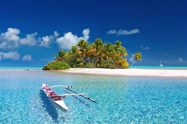
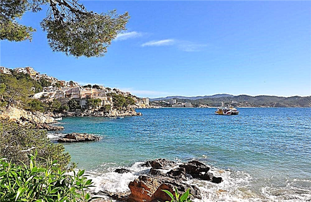
Most people associate the Chelyabinsk region with industry, but the region is also rich in natural beauty. Many people know about some, these are popular holiday destinations, both for locals and visitors. Others are islands of wilderness: not easy to get to, but the experience is worth the effort.
Sightseeing tours and built tourist centers are confirmation that the direction is gaining momentum. While there are not so many tourists, there are flaws in terms of infrastructure, but for not whimsical travelers, the vacation can be exciting and enjoyable. Lakes are scattered throughout the region, so once you find yourself in one of the districts of Chelyabinsk and the surrounding area, you should take a little time and see them with your own eyes.
The most famous Chelyabinsk lakes
List of popular lakes in the region for recreation and fishing.
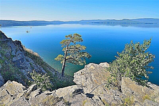
Turgoyak
Located next to the village of the same name. The area is 26.4 km², the average depth is about 20 meters, the coastline stretches for 27 km. It feeds on precipitation, small rivers and streams flowing into it. A distinctive feature is the transparency of the water: the second lake in the country for this indicator. Vera Island and its megaliths are popular tourism destinations. A network of guest houses and boarding houses has been built: "Lake", "Krutiki", "Turgoyak" and others.
Hotels on Booking.com: Turgoyak

Uvildy
It is located in the Argayash region. It is convenient to get there from the Ripus railway station, which is located on the northern shore of the lake. The area is 68.1 km², the average depth is about 15 meters, the coastline is 117 km. Notable places: Golodai and Elm islands. In the immediate vicinity of the lake there are about a hundred places for recreation: the guest house "Ostrov", "Dacha Designer", "Raduga".
Hotels on Booking.com: Uvildy

Kaldy
It is located near several villages, including one near Bolshoi Tuschino. The area is 17.9 km², the average depth is about 5 meters. Popular place for fishing, catching crayfish. Part of the coastline is covered with reeds. The rest of the territory is a forest, places for swimming, recreation centers and cottages: "Kaldinka", "Land of Lakes", "Silver Key" and others. On the southern coast there are parking lots for cars and tents, as well as paid beaches.

Itkul
Located near Verkhny Ufaley. The area is 30.1 km², the average depth is about 8 meters. A visit to the well-maintained beaches is paid. There are sports grounds, toilets, boat rental. Part of the coast is flat. The part is steep with low mountains along the perimeter. The island "Aultash" is made of stones and boulders. Attraction nearby - Shaitan-Kamen. Recreation centers: "Uralelement", "Metelitsa", "Uralskiy Bereg" and others.

Sweet
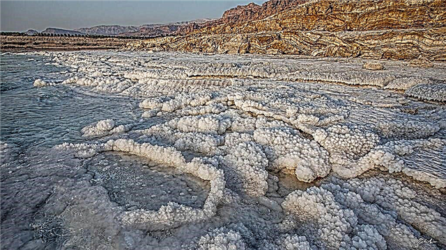
Located near the village of Kocherdyk. The area is 0.32 km², the greatest depth is less than 2 meters. The water has a salty taste, is rich in minerals, and is considered good for the skin, like the local mud baths. They attract tourists, but the infrastructure is poorly developed. There are no fish or algae in the lake. There is a forest complex of the same name, which is also a recreation center. There are places for wild camps.

Spruce
It is located at a distance of one and a half kilometers from Chebarkul. The area is 3.2 km², the average depth is 8 meters, the coastline is 10 km. The shores are from gentle to steep. It warms up well, thanks to the windscreen and small size. There are three islands. Recreation centers and guest houses: "Elovoe", "Kamenny Bereg", "Rodnichok", "Ural Dawns". You can rent everything for a comfortable stay: from barbecues to baths.

Akakul
It is located practically at the intersection of Kyshtym and Ozersk. The area is 10 km², the average depth is about 5 meters. There are small islands, the largest in the center of the reservoir. Boat rental is available. There are mushrooms and berries in the forests nearby, and the Akakul tract is located a kilometer from the coast. Along the coast are located: the health-improving complex of the same name, the Zvezdny rest house, the Pine Hill tourist base.

Sinara
It is located in the Kasli region. The area is 24.4 km², the average depth is about 8 meters, the coastline is 26 km. The Shumikha River connects Sinara with Lake Okunkul. A nearby attraction is the church in Voskresenskoye, built in the first half of the 19th century. A popular holiday destination is the Country House base. There is a cafe, a refined beach, entrance and all services, including parking, are paid.

Sugoyak
It is located in the Krasnoarmeyskiy district. Settlements are located along the coast: Slava, Novy, Lazurny and others. The area is 13.4 km², the average depth is about 4 meters. The lake has a rounded shape, the eastern shore is not suitable for swimming and other recreation, as it is swampy and overgrown with reeds. The beaches are wild without additional services and amenities. There is a hotel of the same name, a tourist center "Yuzhny Bereg" and other options for accommodation by the lake.

Kumkul
It is located in the Argayash region. The area is 5.9 km², the average depth is about 6 meters. Around birch groves, there are areas with thickets of reeds. The depth increases smoothly. The bottom is mostly sandy. The banks are built up with recreation centers and cottages: "Kum-Kul Water Park", "Aviator", "Busman", "Chaika". Some are open all year round. There are many entertainments (slides, playgrounds), a fee is charged for everything.

Chebarkul
The city of the same name is located on the east coast. The area is 19.8 km², the average depth is about 2.5 meters, the largest is 12 meters. The fluctuation of the water level during the year is more than a meter. There are several islands and peninsulas. Parts of the Chelyabinsk meteorite fell on the territory of Chebarkul in 2013. Recreation centers: "Yuzhuralstroyservis", "Rodnichok", "Rassvet" and others. There are camping sites.

Smolino
It is located in two districts at once - Sovetsky and Leninsky. The area is 21.7 km², the average depth is about 4 meters. Villages, gardens and tourist centers are located along the coast. Popular hotels: "Smolinopark Hotel" and "Birch". There are several beaches, all of which are paid. The most equipped is "Sunny Beach": sand is specially brought, sports grounds, a couple of cafes, children's attractions and other amenities.
Hotels on Booking.com: Smolino

Alabuga (Kasli district)
Located near Kasli. The area is 8.8 km², the average depth is about 3 meters. It has the shape of a drop. Fresh water. An insignificant part of the coastline is swampy. Fishing lake, fishing is a popular tourist destination. There is a country club of the same name. There are many convenient places for tents close to the coast. Around the forest-steppe and mixed dense forests.

Arakul
Located near Vishnevogorsk. The area is 3 km², the average depth is about 5 meters. Attraction nearby - Arakul Shikhany. Here were the sites of ancient people. The rock is also used for training rock climbers. The lake is fed by the rivers Kaganka and Olkhovka, as well as a mountain stream. A popular holiday destination is the Arakul Village complex. Here you can rent a boat or sleigh at any time of the year, go in for sports, rent a bathhouse.

Big Kisegach
Located near the city of Chebarkul. The area is 14.2 km², the average depth is about 12 meters, the largest is 34 meters. The geography of the lake is diverse: a dozen large islands, several bays, rivers flowing into it, an indented shore. It is a natural monument. There are tourist centers and hotels in relative proximity. The most visited resting place is the Kisegach sanatorium. In winter, the flow of tourists hardly decreases.

Kasargi
Located in the Sosnovsky district. The area is 14.5 km², the average depth is about 5 meters. The bottom of the east coast is stone, the rest is sandy. On the western side, there are areas with reeds. The water is brackish, but the mineralization is insignificant. A popular holiday destination is the tourist base "Berezka". There is a paid beach with a minimum of services and amenities, as well as affordable prices.

Bitter (Uvelsky district)
Located near Khomutinino.The area is 4.2 km², the average depth is almost 3 meters. The water salinity is increased. It is considered a healing natural object. Local mud is also actively used in cosmetology. The Ural sanatorium exploits all the possibilities of the lake in terms of medicine: from the health-improving climate to water produced under the Uralochka brand. The coast is not built up. There are many places for wild tourism.

Podbornoye
It is located in the Uvelsky district. Area - 1.25 km², maximum depth - 3 meters. The lake is nourished by precipitation and underground sources. A popular holiday destination is the Lesnoye Ozero boarding house. Rich list of services: gym, beach, sauna and others. Near the lake there is a source of mineral water, which is not inferior in composition to the Essentuki. Local silt and clay are also used for cosmetic purposes.

Sandy (Shelomentsevo)
Shelomentsevo is located on the eastern coast. A dense forest grows on the opposite side. The lake is also named after the village. The area is 1.42 km², the average depth is just over 4 meters. The water is fresh, the reeds have captured part of the coastal zone. Recreation centers: "Kind Moose", "Horizon", "Ray" and others. There is a children's camp "Birch". The best beach on the coast is located next to it.

Zyuratkul
It is located in the Satka region. It is a reservoir. Part of the national park. The area is 13.2 km², the average depth is 3.4 meters, the largest is about 12 meters. The water has a dirty tint, as the lake is fed from streams with sources in a marshy area. Around mountain ranges and coniferous forests. An attraction nearby is the Los geoglyph. Nearby there is a paid pond "Fisherman's Orgasm". Tourist bases: "Mountain House", "Taiga House" and others.

Argazi
It is located in the Argayash region. The lake became part of the reservoir of the same name, formed on the Miass River during the construction of the dam. The area is 84.4 km², the average depth is 12 meters. The water level varies within 6 meters. The forest almost reaches the tide line. There are islands, some of which are partially flooded. Popular recreation centers: "Birch", "Aloha" and about ten more.

Big Kuyash
Located near the village of Ognevskoye. Area - 22 km², average depth - 3 meters. The bottom near the western coast is muddy with an abundance of snags, the rest is sandy. The water is brackish, the transparency is high. Through the isthmus, the lake is connected with Small Kuyash. There is a fishing farm. One of the most popular holiday destinations is the Sova tourist center. Lots of convenient tent sites.

Blue (Kaolin quarry)
The place is located 90 km from Chelyabinsk near the city of Kyshtym. It is a former kaolin quarry. The water that flooded it has a characteristic azure hue. The lake is often called "Ural Bali". The maximum depth is about 7 meters, due to the high concentration of clay and minerals, there are no fish in the reservoir. In 2011, the industrial development of the quarry ceased, and the site became a popular wilderness destination.

Sungul
Located near Vishnevogorsk. The area is 11.5 km², the average depth is 2 meters, the largest is 8 meters. It is connected by channels with other lakes. One of the cleanest in the Urals. The water is rich in minerals. The bottom is predominantly muddy. There are about 20 islands. The coast is steep in places, covered with stones, there are cliffs. The sanatorium of the same name and several tourist centers are located nearby.

Big Elanchik
Located in the Chebarkul region. The area is 5.8 km², the average depth is about 4 meters. The Gryaznukha river flows in, the Kundurusha flows out. There are two islands and one large peninsula dividing Elanchik into two sectors. The eastern shore is pitted with pencil pits: graphite was mined here in the past. There are many places for recreation: sanatorium "Alyonushka", camp sites "Green light", "Chelyabvtormet" and others.

Etkul
It is located in the Etkul region near the village of the same name. A relic forest grows on the opposite bank. The area is 4.5 km², the average depth is about 2 meters. It looks like a bob. Through the isthmus, it has a connection with Lake Khokhlovaty. Since its inception, it has undergone many changes. This also applies to recharge from now dry rivers. A recreation center was built on the shore.

Uzunkul
Located in the Sosnovsky district. The area is 4.2 km², the average depth is about 3 meters. The lake feeds on precipitation and when the snow cover melts. The water is very clean and salty. The coast is heterogeneous, there are rocky areas. Algae have taken over part of the lake. Fishing is varied, there are even special places for donoks. There are several summer cottages in the district. One of the most popular recreation centers is Kamyshi.

Treustan
It is located in the Krasnoarmeyskiy district. The area is 15.2 km², the average depth is about 2 meters. The coastline is rugged, there are wetlands and thickets, springs flow. The water is almost opaque, salty, there is a lot of flooded forest and driftwood in it. Depending on the season, the water level changes significantly. There is nowhere to stay nearby, but there are many places for wild tourism.

Long
Located 8 kilometers from Kasli. The area is 10 km², the average depth is about 3 meters, the shape of the lake is elongated. There are bays. The water is clear. They come here mainly for fishing. You can stay in the cottage complex of the same name or in the "Tourist" recreation area. There are also car parks equipped with awnings, camp baths and other necessary minimum.

Tishki
It is located near the villages of Malye Tishki, Dubrovka and Surakova. The area is 18 km², the average depth is about 2.5 meters. In it, especially near the coast, there are submerged driftwood and even large debris. The bottom, like the coast, is sandy from the side of the villages, the rest is mostly muddy. The hunting base and the "Fisherman's House" are popular as stops.